

FEMA flood zone maps are used to assess the likelihood of flooding in specific areas across the United States. These maps include Flood Insurance Rate Maps (FIRMs) and Flood Hazard Boundary Maps, which classify regions into zones based on varying levels of flood risk.
With more than 20,000 communities mapped, these zones help inform insurance requirements and development decisions. Homebuyers and property owners are encouraged to research flood risk—even in states that don’t require sellers to disclose past flooding.
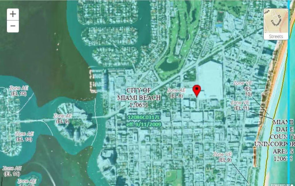
You can access flood maps through the FEMA Flood Map Service Center using a street address, or use tools like ClimateCheck for a broader risk analysis. For detailed guidance, refer to our full FEMA flood map guide.
Read More: Understanding FEMA Flood Zones: Categories A Through X
The Importance of FEMA Flood Zones
Understanding your FEMA-designated flood zone is essential for assessing both the physical and financial risks to your property. These zones help determine the likelihood of flooding and directly influence flood insurance requirements and premiums.
Properties located in Special Flood Hazard Areas (SFHAs) face the highest risk of flooding, mudflows, or flood-related erosion, and flood insurance is often mandatory in these areas.
FEMA flood zone designations include categories such as A, AE, AH, AO, A99, V, and VE for high-risk areas, while zones labeled B, C, or X represent moderate to low risk. Zone D indicates areas with undetermined but possible flood risk.
Though FEMA maps are valuable, they often do not fully capture changing flood patterns due to climate change or account for surface-level flooding from heavy rainfall. Additionally, flood risk is often described using “100-year” (1% annual risk) and “500-year” (0.2% annual risk) flood zones.
For a complete understanding, FEMA and other government resources provide in-depth explanations of each zone classification.
Low and Moderate Risk Areas: FEMA Flood Zones B, C, and X
FEMA Zones B, C, and X represent areas with lower flood risk compared to high-risk zones, and are classified as Non-Special Flood Hazard Areas (NSFHAs). While these zones fall outside of the designated Special Flood Hazard Areas (SFHAs), flood risk still exists and should not be ignored.
Properties in these zones typically face less than a 1% annual chance of flooding. However, statistics show that approximately 20% of all flood insurance claims originate from these lower-risk areas, and they account for about one-third of federal disaster assistance payouts.
Although federal flood insurance is not mandatory in these zones, it is strongly recommended for all property owners and managers.
Zones B and X (Shaded):
These indicate moderate flood risk and generally fall between the 100-year and 500-year flood thresholds. Zone B areas may include regions protected by levees, dams, or subject to shallow flooding (less than one foot in depth).
Zones C and X (Unshaded):
These areas have minimal flood risk, typically above the 500-year flood level. Zone C may experience localized drainage or ponding issues, while unshaded Zone X areas are often outside major flood zones and may be protected from 100-year flood events by levees or similar infrastructure.
High-Risk Areas: FEMA Flood Zone A and Related Classifications
FEMA designates certain regions as high-risk flood zones, where properties face a 1% annual chance of flooding, translating to a 25% chance over the span of a 30-year mortgage.
These areas—commonly near rivers, streams, and ponds—are marked with the letter “A” and are subject to mandatory flood insurance requirements for federally backed mortgages.
A key metric in high-risk zones is the Base Flood Elevation (BFE), which estimates how high floodwaters are likely to rise during a base flood event. Understanding BFE is essential for building compliance, insurance rates, and overall flood risk assessment.
The following FEMA zones fall under this high-risk category, each with specific characteristics:
Zone A:
Areas with a 1% annual chance of flooding. These zones are not based on detailed analyses and do not include base flood elevations or flood depths.
Zones AE / A1–A30:
High-risk zones with published BFEs. These are updated designations where A1–A30 represent older FIRM formats.
Zone AH:
Areas subject to shallow flooding (1 to 3 feet) with a 1% annual chance. BFEs are indicated.
Zone AO:
Areas affected by sheet flow or shallow flooding from rivers or streams. Average flood depths are provided instead of precise elevations.
Zone AR:
Regions with a temporary increased flood risk due to the ongoing restoration of flood control systems (e.g., levees or dams) that have lost certification. Flood insurance remains mandatory.
Zone A99:
Areas where a federal flood protection system is under construction and has reached a level of progress deemed sufficient for flood insurance rating purposes. Although these areas are still at 1% annual risk, BFEs and flood depths are not shown.
High-Risk Coastal Areas: FEMA Flood Zone V
Coastal flood zones represent some of the most hazardous flood-prone regions in the United States. FEMA Zone V designations identify areas along coastlines that are vulnerable not only to a 1% or greater annual chance of flooding, but also to the additional dangers of storm surge and wave action.
These high-energy events can cause severe damage to properties, infrastructure, and natural coastal environments.The impacts of sea level rise and coastal land subsidence, both influenced by climate change, are expected to significantly increase the frequency and severity of flooding in these zones.
For communities that participate in the National Flood Insurance Program (NFIP), mandatory flood insurance is required for properties located in these coastal zones.
FEMA Coastal Flood Zone Classifications
Zone V:
Coastal areas with a high flood risk and exposure to storm-induced waves. These zones do not include Base Flood Elevations (BFEs) due to a lack of detailed hydraulic studies.
Zones VE / V1–V30:
These zones include all the flood hazards of Zone V but provide Base Flood Elevation data, which are determined through detailed hydraulic analyses. This information is essential for construction planning and insurance rate determination.
Undetermined Risk Areas: FEMA Flood Zone D
Flood Zone D represents areas where flood risk has not been adequately assessed. These zones may or may not be prone to flooding, but due to limited data, FEMA cannot assign a specific flood hazard level.
As a result, insurance is not mandatory, but it is available—often at rates that reflect the uncertainty of potential risk.It’s important to note that many properties, particularly in underserved and minority communities, may face undisclosed or underestimated flood risk.
As flood mapping and climate data evolve, previously overlooked areas may become more clearly identified as high-risk in the future.
Frequently Asked Questions (FAQs)
What is a FEMA flood zone?
A FEMA flood zone is a geographic area categorized by the Federal Emergency Management Agency (FEMA) based on its likelihood of flooding. These zones help determine flood risk and influence insurance requirements and building regulations.
What is the difference between Zone A and Zone V?
Zone A represents areas at high risk of flooding, typically near rivers and streams, with no storm surge threat. Zone V, on the other hand, applies to coastal areas subject to storm surge waves and other flood risks, including high-energy wave action.
Are flood insurance requirements the same for all flood zones?
No. Flood insurance is mandatory in Special Flood Hazard Areas (SFHAs), including Zone A and Zone V for properties with federally-backed mortgages. For lower-risk zones (B, C, X), insurance is optional, but recommended.
What is Base Flood Elevation (BFE)?
Base Flood Elevation (BFE) is the predicted height floodwaters are expected to reach during a 100-year flood event (with a 1% annual chance of flooding). The BFE is used to determine building requirements and flood insurance rates.
How can I find out what flood zone my property is in?
You can find your property’s flood zone by visiting the FEMA Flood Map Service Center and entering your address. Additionally, you may consult local government resources or use private tools like ClimateCheck for a more comprehensive climate risk report.
What does “100-year flood” mean?
A 100-year flood refers to a flood event that has a 1% chance of occurring in any given year. It does not mean the event happens once every 100 years, but rather the statistical likelihood of it occurring in any single year.
Conclusion
These zones are instrumental in determining the likelihood of flooding, establishing insurance requirements, and guiding construction practices to reduce potential damage. High-risk areas, such as Zone A and Zone V, require special attention, but it is important to recognize that lower-risk zones, like Zone B, C, and X, are not immune to flooding events. With the increasing impact of climate change on flood patterns, staying informed about flood zone designations and securing proper flood insurance is essential.