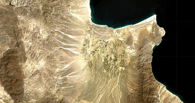
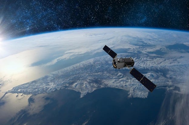
Satellite imaging offers clear, data-driven answers to everyday questions—whether it’s evaluating crop health, tracking construction progress, or identifying traffic delays in a supply chain. With high-resolution views of Earth, organizations can make informed decisions and avoid costly mistakes.
The true game-changer is accessibility. What once required massive government funding and scientific expertise is now available to anyone. Modern cloud platforms allow users to easily download the latest satellite imagery and extract actionable insights within minutes.
From agriculture and logistics to urban planning and environmental monitoring, satellite technology has evolved into an essential tool across sectors—helping professionals uncover trends, mitigate risks, and seize opportunities that might otherwise remain hidden.
Read More: Beginner’s Guide to Earth Observation with Satellite Technology
How Satellites Capture and Transmit Data
Satellites function as advanced observers in space, equipped with specialized sensors designed to collect detailed information about Earth’s surface and atmosphere. These sensors fall into two primary categories: passive and active.
Passive sensors detect naturally occurring energy, such as reflected sunlight or emitted heat, while active sensors emit their own signals—typically in the form of microwaves—and analyze the reflections to gather data.
Common sensor types include multispectral sensors, which capture light across various wavelengths to reveal insights into vegetation health, land use, and ocean conditions; radar sensors, which penetrate cloud cover, smoke, and even nighttime darkness; and thermal sensors.

Which detect heat variations useful for tracking wildfires, volcanic activity, and urban heat zones.Once data is collected, satellites transmit it to Earth via radio waves during scheduled connections with ground stations.
Low Earth orbit satellites, which circle the planet rapidly, have limited windows for these transmissions, while geostationary satellites maintain constant alignment with specific areas on Earth, ensuring continuous communication.
After transmission, raw satellite data undergoes processing to transform it into usable maps, visualizations, and analytical tools that support decisions across sectors—from agriculture and logistics to environmental management.
Types of Satellite Imagery and Their Applications
Satellite imagery comes in several forms, each defined by the type of sensor used to capture it—and each offering a unique perspective to address specific challenges on Earth. Broadly, the three primary types of satellite imagery are optical, radar, and infrared, and each plays a vital role across diverse sectors.
Optical imagery
Optical imagery relies on sunlight to capture Earth in visible and near-infrared wavelengths. It’s the most familiar type of satellite image, used extensively to observe land cover, vegetation health, water bodies, and urban development. Urban planners use high-resolution optical imagery to map infrastructure and monitor city expansion.
Environmental researchers rely on it to track deforestation, while farmers use it to assess crop health, monitor growth patterns, and optimize fertilizer application. However, optical sensors are limited by weather and lighting—they cannot see through clouds or capture images at night.
Radar imagery
Radar imagery, by contrast, operates independently of sunlight and weather conditions. Synthetic Aperture Radar (SAR) emits microwave pulses and measures their reflections to generate highly detailed images of Earth’s surface, regardless of cloud cover or time of day.
This makes radar invaluable for emergency response teams—enabling them to map flood zones during storms or detect subtle land shifts that might signal impending earthquakes. Radar is also widely used for monitoring glacier movement, measuring deforestation under cloud cover, and tracking land subsidence in cities.
Infrared imagery
Infrared imagery captures thermal radiation emitted by the Earth’s surface, rather than visible light. These images highlight temperature variations across landscapes, making them essential for detecting environmental stress.
Firefighters use infrared imagery to identify hotspots obscured by smoke. Agricultural experts use it to detect early signs of drought stress in crops—well before visual symptoms appear. Urban planners analyze infrared data to identify and mitigate urban heat islands, improving energy planning and climate resilience.
While each type of satellite imagery offers powerful insights on its own, their greatest strength emerges when combined. For example, farmers can merge optical imagery of crop vigor with infrared indicators of drought stress to make timely, yield-saving decisions.
Emergency responders overlay radar-based flood maps with optical views of infrastructure to coordinate relief and rescue efforts more effectively. Together, these technologies work in harmony—delivering real-time intelligence that drives informed action across the globe, every single day.
How Cloud Platforms Are Making Satellite Data Accessible to Everyone
Accessing satellite imagery no longer requires advanced technical expertise or expensive software. Thanks to modern cloud-based platforms, satellite data has become widely available and incredibly user-friendly—empowering businesses, researchers, and even individuals to gain insights from space without specialized training.
Simplified Access for All Users
What once demanded a PhD or high-level computing resources is now as intuitive as using a map app. Cloud platforms have removed barriers to entry, offering simple interfaces that allow users to view, analyze, and interpret satellite images with minimal effort.
Diverse Data Sources in One Place
Leading platforms such as EOSDA LandViewer, Google Earth Engine, and others bring together a wide range of satellite data in one environment.
They integrate imagery from open-access missions like Sentinel-2 and Landsat 8, along with commercial sources, providing multi-temporal, multi-resolution perspectives for any location on Earth.
Pre-Processed, Ready-to-Use Imagery
To eliminate technical complexity, these platforms often serve pre-processed imagery—highlighting vegetation health, water bodies, urban areas, and more. This makes it easier for non-specialists to extract meaningful information without diving into raw data calibration or correction workflows.
Built-In Analytical Tools
Many cloud platforms offer built-in analytics, such as vegetation indices (NDVI, EVI), change detection tools, and time-series analysis. These tools allow users to monitor trends, detect anomalies, and conduct research or project planning—all without needing third-party software or deep technical skills.
Freemium Access Models
To ensure broad adoption, most platforms include free tiers that offer access to the latest satellite imagery and basic features. For more advanced needs—like high-resolution downloads or historical datasets—subscription plans are available, making high-quality analysis scalable and affordable.
Seamless Integration and Sharing
Users can download satellite images, integrate them into GIS software, or share them directly with stakeholders. Whether for environmental reporting, academic research, or local development planning, these tools provide high-value insights quickly and collaboratively.
Real-World Impact
This new level of accessibility has transformed satellite data from a government or corporate asset into a tool for startups, small businesses, NGOs, educators, and communities.
From monitoring deforestation to optimizing agricultural yield or assessing urban growth, satellite imagery is now informing decisions that were previously out of reach.
The Rapid Evolution of Earth Observation Technologies
Once confined to the realm of scientists and government agencies, Earth observation has now become a mainstream resource for daily decision-making across industries.
The real breakthrough isn’t just in the sophistication of satellites, but in the widespread availability of data—thanks to cloud platforms that simplify access and eliminate the need for complex technical processing.
A transformative development in this space is the integration of artificial intelligence, which enables real-time analysis of satellite imagery. This innovation is especially vital when time-sensitive decisions must be made, from disaster response to supply chain monitoring.
Meanwhile, private-sector initiatives are accelerating the expansion of satellite-based internet, bringing reliable connectivity to underserved and remote regions worldwide.Despite significant progress, the sector faces ongoing hurdles such as space debris, high production costs, and tight regulatory controls.
However, emerging solutions like satellite miniaturization, 3D-printed components, and advanced debris-removal technologies are actively addressing these challenges. These innovations are not only reducing the environmental footprint but also making satellite deployment more efficient and sustainable for the future.
Frequently Asked Questions (FAQs)
What is Earth observation?
Earth observation involves collecting data about the planet’s physical, chemical, and biological systems using satellites or other remote sensing technologies. It’s used to monitor climate, land use, oceans, agriculture, and more.
How do satellites capture images of Earth?
Satellites use various sensors—optical, radar, and infrared—to capture images. These sensors detect reflected sunlight, emitted thermal energy, or bounced-back radar signals to generate detailed images of the Earth’s surface.
Can anyone access satellite imagery?
Yes. Thanks to cloud platforms like EOSDA LandViewer, Google Earth Engine, and Sentinel Hub, satellite imagery is now accessible to the public—including researchers, businesses, and individuals.
What is the role of AI in satellite data analysis?
Artificial intelligence helps automate and accelerate the analysis of satellite data. It enables real-time insights, supports predictive modeling, and minimizes manual interpretation errors.
How often are satellite images updated?
This depends on the satellite. Some, like Sentinel-2, revisit the same location every 5 days. Others, like weather satellites, can capture images multiple times per day.
Is satellite data useful for small businesses?
Absolutely. From agriculture to construction to logistics, satellite insights help small businesses optimize operations, monitor assets, and make data-driven decisions affordably.
Conclusion
Satellite technology has evolved from a complex scientific tool into an everyday asset, empowering industries, governments, and individuals with real-time, actionable insights. From monitoring crop health and tracking natural disasters to managing urban development and environmental conservation, Earth observation has become indispensable.

